
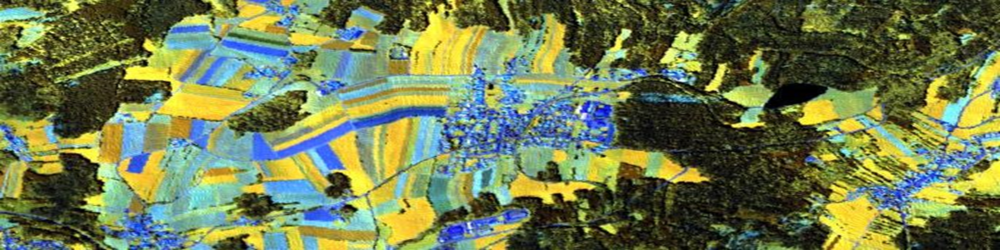
Water Management and Agriculture
Contact: Martin Wegmann
Sixth CAWa Summer School (2019)
- Subject: Introduction to GIS and Remote Sensing for Land and water resources monitoring
- Time and Place: 15th to 19th July 2019, German-Kazakh University (DKU), Almaty, Kazakhstan
- Audience: Master and PhD students, junior university teachers and young specialists from government agencies and research institutions from Central Asia and Afghanistan
- Software: QGIS Desktop-3.8 with several plugins
- language: English
- Trainer: Lucia Morper-Busch, Maik Netzband
- Co-Trainer: Gulnara Iskaliyeva (Kazakhstan)
Third CAWa Edu Seminar (2019)
- Subject: Introduction to GIS and Remote Sensing for Land and water resources monitoring
- Time and Place: 9th to 13th July 2019, State Scientific Institution “Center for Research of Glaciers”, Academy of Sciences of the Republic of Tajikistan, Dushanbe
- Audience: Junior and senior researchers from Tajikistan
- Software: QGIS Desktop-3.8 with several plugins
- language: Teaching material in English, Lecture language English and Russian
- Trainer: Lucia Morper-Busch, Maik Netzband
- Translator: Jafar Niyazov (Tajikistan)
Second CAWa Edu Seminar (2018)
- Subject: Introduction to GIS and Remote Sensing for Land and water resources monitoring
- Time and Place: 12th to 17th October 2018, Kyrgyz National Agrarian University (KNAU), Bishkek, Kyrgyzstan
- Audience: Young researchers and stakeholders from Kyrgyzstan, Tajikistan and Afghanistan
- Software: QGIS Desktop-2.18 with several plugins
- language: English
- Trainer: Lucia Morper-Busch, Maik Netzband
First CAWa Edu Seminar (2018)
- Subject: Introduction to GIS and Remote Sensing for Land and water resources monitoring
- Time and Place: 13th to 19th June 2018, Tashkent Institute of Irrigation and Agricultural Mechanization Engineers (TIIAME), Tashkent, Uzbekistan
- Audience: Master students, junior university teachers and young specialists from research institutions from Uzbekistan
- Software: QGIS Desktop-2.18 with several plugins
- language: English
- Trainer: Lucia Morper-Busch, Maik Netzband
Fifth CAWa Summer School (2018)
- Subject: Introduction to GIS and Remote Sensing for Land and water resources monitoring
- Time and Place: 11th to 15th June 2018, German-Kazakh University (DKU), Almaty, Kazakhstan
- Audience: Master and PhD students, junior university teachers and young specialists from government agencies and research institutions from Central Asia and Afghanistan
- Software: QGIS Desktop-2.18 with several plugins
- language: English
- Trainer: Lucia Morper-Busch, Maik Netzband
- Co-Trainer: Serikzhan Atanov (Kazakhstan)
Third LaVaCCA Summer School (2017)
- Subject: Advanced analysis with raster data in
- time and Place: 08.11. – 11.11.2017, Urgench State University in Urgench, Usbekistan
- Audience: Students and doctoral candidates from Uzbekistan and Kazakhstan
- Software: R
- language: English
- Trainer: Michael Thiel
- Trainer: Shavkat Kenjabaev, Murodjon Sultanov, Olga Degtyareva, Chrstian Bauer, Mirzakhayot Ibragimov
Fourth CAWa Summer School (2017)
- Subject: Raster Image Analysis, Land Use Classification and Web Mapping (Introduction to WUEMoCA)
- Time and Place: 05.08. – 08.06.2017, German-Kazak University (DKU), Almaty, Kasakistan
- Audience: Academic and political experts from Central Asia and Afghanistan
- Software: QGIS
- language: English, Russian
- Trainer: Lucia Morper-Busch, Dimo Dimov
- Co-Trainer: Mustakim Akhmedov (Tajikistan), Sherzod Zaitov (Usbekistan)
Third CAWa Summer School (2016)
- Subject: Raster Image Analysis, Land Use Classification and Web Mapping (Introduction to WUEMoCA)
- Time and Place: 06.06 – 11.06.2016, german-Kazak University (DKU), Almaty, Kazakistan
- Audience: Academic and political experts from Central Asia and Afghanista
- Software: QGIS
- Language: English, Russian
- Trainer: Lucia Morper-Busch, Dimo Dimov
- Co-Trainer: Sherzod Zaitov (Usbekistan)
Second LaVaCCA Summer School (2015)
- Subject: Advanced analysis with raster data in
- time and Place: 29.06. – 02.07.2015, Büro der NGO "KRASS" in Urgench, Usbekistan
- Audience: Experts and scientists of the partner organizations of the LaVaCCA projec
- Software: R
- language: English
- Trainer: Christian Bauer
First LaVaCCA Summer School (2015)
- Subject: Advanced analysis with raster data in
- Time and Place: 12.02. – 17.02.2015, Al´Farabi Kazak National University, Kazakistan
- Audience: Experts and scientists of the partner organizations of the LaVaCCA project
- Software: R
- Language: English
- Trainer: Christian Bauer
Second CAWa Summer School (2015)
- Subject: Introduction to GIS and Remote Sensing
- Time and Place: 15.06. – 20.06.2015, German-Kazak University (DKU), Almaty, Kazakistan
- Audience: Academic and political experts from Central Asia and Afghanista
- Software: ArcGIS
- Language: English, Russian
- Trainer: Lucia Morper-Busch, Dimo Dimov
First CAWa Summer School (2014)
- Subject: Remote Sensing, GIS and Integrated Land and Water Resources Management
- Time and Place: 12.05. – 24.05.2014, German University (DKU), Almaty, Kazakistan
- Audience: cademic and political experts from Central Asia and Afghanistan
- Software: ArcGIS, MS Office
- Language: English, Russian
- Trainer: Christopher Conrad
Remote Sensing for Hydrological Monitoring (2013)
- Subject: Image analysis and classification
- Time and Place: 05.08.– 09.08.2013, Central Asian Institute of Applied Geosciences (CAIAG), Bishkek, Kirgisistan
- Audience: Academic and political experts from Central Asia and Afghanistan
- Software: ArcGIS , Google Earth
- Language: English, Russian
- Trainer: Sylvia Seissiger, Alexandra Breiter
Land use mapping in the Isafara Basin (2012)
- Subject: Raster image analysis, land use classification and watershed modeling
- Time and Place: 01.10.–26.10.2012, Hydrometeorological surveillance in Tajikistan and Kirgistan
- Audience: Representatives of public authorities
- Software: ArcGIS, Google Earth
- language: Russian, English
- Trainer: Christopher Conrad, Gunter Schorcht, Elisabeth Fliemann
Remote sensing for hydrometeorological monitoring (2012)
- Subject: Image analysis and hydrological modelling
- Time and Place: 16.07.2012 – 20.07.2012, GFZ, Potsdam, Germany
- Audience: Central Asian public authorities and universities
- Software: ArcGIS
- Language: English, Russian
- Trainer: Gunther Schorcht, Elisabeth Fliemann
Introduction to GIS and Fernerkundung (2011)
- Subject: Geostatistics using Remote Sensing and GIs
- Time and Place: 05.09. - 14.09.2011, Urgench State University (UrDU), Urgench, Usbekistan
- Audience: Staff and students of UrDU
- Software: ArcGIS
- Language: English, Russian
- Trainer: Gunther Schorcht, Fabian Löw
Land Use and Land Cover Remote Sensing for Water Management (2011)
- Subject: Introduction to Remote Sensing
- Time and Place: 15.08. - 19.08.2011, GFZ, Potsdam, Germany
- audience: Central Asian institutions with a focus on irrigation of agricultural land
- Software: ENVI
- Language: English, Russian
- Trainer: Doris Klein, Sylvia Seissiger
Training program in GIS and remote sensing for higher education in Uzbekistan (2011)
- Subject: GIS and Remote Sensing
- Time and Place: 23.03. - 01.04.2011, Urgench State University (UrDU), Urgench, Usbekistan
- Audience: Staff and students of UrDU
- Software: ArcGIS
- Language: German, Russian
- Trainer: Gunther Schorcht, Fabian Löw
Developing capacities in the fields of GIS and remote sensing (2010)
- Subject: Introduction to geographic information systems
- Time and Place: 24.08. - 03.09.2010, Urgench State University (UrDU), Urgench, Usbekistan
- Audience: Staff and students of UrDU
- Software: ArcGis
- language: German, Russian
- Trainer: Gunther Schorcht, Fabian Löw

