
Introduction to GIS and Fernerkundung (2011)
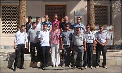
The State University of Urgench (UrDU) in Uzbekistan in cooperation with the ZEF/UNESCO project and the University of Würzburg organized an advanced practical training on modern Geographic Information Systems (GIS) techniques and remote sensing (RS) methodology from September 5th to September 14th, 2011. The training was open to staff members from UrDU as well as to people involved in applications of GIS data and GIS&RS methodologies in Uzbekistan. This third course in the frame of the “training of trainers” program focused on practical usage of theory gained in the first courses held at UrDU in September 2010 and April 2011.
The acceptance and the sustainability of the programme was evidenced by the number of participants and their interest of using GIS/RS in different environments. Numerous participants with no link to the university attended this course, unlike the first two courses, which indicates the successful dissemination of the knowledge in the region. Among the participants were engineers from Karakalpakstan, UNESCO staff members from Tashkent as well as staff members from the UrDU who attended already the third time. The wide spread of knowledge in this very specific discipline underlines the effort of the UrDu to become a center of competence for GIS and RS in Uzbekistan.
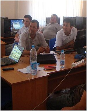
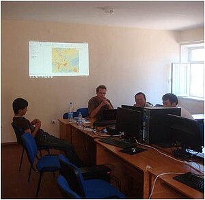
The course focused on complex geographical issues and applications within ecology, economics and agricultural sciences: e.g. analysing and assessing regional water usage, spatial analysis of ecological parameters, and exploration of the distribution of non-used lands in the agricultural system of Khorezm. All questions were addressed using spatial datasets, remote sensing data and data from secondary sources, which had to be combined, analysed and interpreted correctly. Many participants integrated own data and problems and supported therewith the practical expectation of the course. Two scientists affiliated with the ZEF/UNESCO project, Gunther Schorcht and FabianLoew (both from the University of Würzburg in Germany and also teachers in the first training courses) leaded the course and prepared documentations for the participants.After a presentation of their results, all participants received a certificate.
The ZEF/UNESCO project in Urgench is a long-term scientific project with close collaborations of local partners such as UrDU and which focuses on improving natural resource management in the region. Developing human capacity, especially in modern and strong demanded remote sensing science, is an important part of the German-Uzbek project.
Outline of the course
Day 1 (repetition):
- Basic steps in ArcGIS 10
- ArcGIS Toolbox
- ArcGIS & Excel (export, import)
- GPS and other data sources o Digitization and attribute table
- Creating maps (graphs, statistics, images)
- Creating reports
Day 2 (repetition advanced course, statistics)
- (Continuation of repetition of day 1)
- Advanced Tools
- Using ArcGIS: experiences from the participants (short discussion)
- Day 3 (statistics)
- Introduction into statistical methods (descriptive, spatial)
- Descriptive statistics in ArcGIS o Examples of application of geo statistics (e.g. interpolation of climate data, soil data, canal network density, etc.)
Day 4-5 (geostatistics)
- Theory of spatial (geo-) statistics (geographic distribution, auto correlation, interpolation, geographically weighted regression, semivariance, etc.)
- Explore data, working with Geostatistical Wizard:
- verify data features: distribution (normality, histogram), dependency, stationarity
- spatial trends in spatial data, visualization in GIS
- understand spatial autocorrelation (check and interpret semivariogram)
Day 6-8 (advanced processing)
- Project: “Water management on the example of Khorezm”
- Data integration, analysis, manipulation, maps, reports
Day 9 (finalization of the course)
- Participants project presentation
- Short repetition of the course
- Certificates
Teaching material is available on request.

