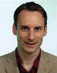
Dr. Tobias Landmann

Anstellung am Lehrstuhl:
12/2005 - 08/2012
Forschungsprojekte am Lehrstuhl:
Arbeitsgruppenleiter: (Fernerkundung und "Landscape Dynamics") in West African Science Service Center on Climate Change and Adapted Land Use (WASCAL)
Mitarbeit im Forschungsprojekt "Wasser in Zentralasien" (CAWa)
Teilprojektleiter: BIOTA West, Fernerkundung für die Biodiversität in Afrika.
Projektleiter GLOWA VOLTA, Fernerkundung, Veränderung der Landoberfläche für die Hydrologische Modellierung (land cover and land cover change)
Publikationen am Lehrstuhl
(wird an dieser Stelle nicht weiter gepflegt)
- Schramm, M.; Landmann, T.; Machwitz, M.; Schmidt, M.; Dech, S. (2010): Continuous tree density data as derived by remote sensing. In: Biodiversity Atlas of West Africa, Volume II: Burkina Faso, 98 - 101.
-
Yao, N. A.; Landmann, T.; Schmidt, M.; Konaté, S.; Dech, S.; Linsenmair, K. E. (2010): Fire as an agent for vegetation structure & diversity. In: Biodiversity Atlas of West Africa, Volume II: Burkina Faso, 64 - 71.
-
Landmann, T.; Machwitz, M.; Schmidt, M.; Dech, S.; Vlek, P. (2010): Land cover change in West Africa as observed by satellite remote sensing. In: Biodiversity Atlas of West Africa, Volume II: Burkina Faso, 92 - 97.
- Landmann, T.; Machwitz, M.; Le, Q. B.; Desta, L.; Vlek, P.; Dech, S.; Schmidt, M. (2008): A land cover change synthesis study for the GLOWA Volta Basin in West Africa using time trajectory satellite observations and cellular automation models. In: Proceedings of the 2008 IEEE International Geoscience and Remote Sensing Symposium
-
Landmann, T.; Colditz, R.; Schmidt, M.; Dech, S. (2007): A Land Cover Classification System (LCCS) based wetland biodiversity characterization method for West African savannas using 250-Meter MODIS observations. In: 32nd International Symposium on Remote Sensing of Environment
-
Landmann, T.; Schmidt, M.; Dech, S.; Schramm, M.; Vogel, M. (2006): A new spatially-explicit and object-conditional land cover (LC) data set based on the FAO Land Cover Classification System (LCCS) for the GLOWA catchment area. In: 6th International Conference of the African Association of Remote Sensing of the Environment (AARSE)
-
Landmann, T.; Vlek, P. J.; Schmidt, M.; Dech, S.; Cord, A. (2007): An object-conditional approach for satellite remote sensing land cover mapping in African Savannas. In: Proceedings of the Third International Workshop on Information Fusion and Geographical Information Systems (IFGIS)
-
Landmann, T.; Schmidt, M.; Colditz, R. R.; Dech, S. (2007): An object-conditional land cover classification system (LCCS) based wetland biodiversity characterization method for West African savannas using 250 meter MODIS observations. In: 32nd International Symposium on Remote Sensing of Environment
-
Landmann, T.; Colditz, R. R.; Schmidt, M. (2006): An object-conditional land cover classification system (LCCS) wetland probability detection method for west African savannas using 250-meter MODIS observations. In: ESA-ESRIN GlobWetland Symposium
-
Yao, N. A.; Schmidt, M.; Landmann, T.; Konaté, S.; Dech, S.; Linsenmair, K. E. (2008): Bushfire distribution in the subsahelian West Africa using satellite Imagery. In: 7th International Conference of the African Association of Remote Sensing of the Environment (AARSE)
-
Colditz, R. R.; Geßner, U.; Conrad, C.; van Zyl, D.; Malherbe, J.; Newby, T.; Landmann, T.; Schmidt, M.; Dech, S. (2007): Dynamics of MODIS time series for ecological applications in southern Africa. In: Fourth international Workshop on the Analysis of Multitemporal Remote Sensing Images (MultiTemp)
-
Ruecker, G.; Wehrmann, T.; Schettler, I.; Conrad, C.; Landmann, T.; Klein, D.; Fritsch, S.; Schorcht, G.; Mund, J. P.; Kuenzer, C.; Keil, M.; Mehl, H.; Dech, S. (2009): Integration of remote sensing products in regional information systems to support decision making in land and water management in Central Asia. In: Proceedings of the Third Central Asia GIS Conference - GISCA '09 (Bishkek)
-
Machwitz, M.; Landmann, T.; Cord, A.; Conrad, C.; Dech, S. (2008): Land cover analysis on sub-continental scale: FAO LCCS standard with well-defined 250 meter MODIS satellite observations in West Africa. In: Proceedings of the 2008 IEEE International Geoscience and Remote Sensing Symposium
-
Landmann, T.; Herty, C.; Dech, S.; Schmidt, M.; Vlek, P. (2007): Land cover change analysis within the GLOWA Volta basin in West Africa using 30-meter Landsat data snapshots. In: Proceedings of the 2007 IEEE International Geoscience and Remote Sensing Symposium
-
Abdel-Rahman, E.; Kyalo, R.; Landmann, T.; Thiel, M.; Nyasani Le Ru B., J. (2016): Maize pest and diseas mapping using RapidEye-based vegetation indices and machine learning methods. In: AARSE 2016
-
Yao, N. A.; Schmidt, M.; Landmann, T.; Wegmann, M.; Konaté, S.; Penner, J.; Rödel, M. -O.; Fahr, J.; Linsenmair, K. E. (2006): Satellite derived spatial and temporal distribution of fire activity in subsahelian West Africa. In: 6th International Conference of the African Association of Remote Sensing of the Environment (AARSE)
-
Wegmann, M.; Colditz, R. R.; Fahr, J.; Landmann, T.; Linsenmair, K. E.; Penner, J.; Rödel, M. -O.; Schmidt, M.; Sommer, H.; Dech, S. (2006): Spatio-temporal analysis of African landscapes for biodiversity research. In: 6th International Conference of the African Association of Remote Sensing of the Environment (AARSE)
-
Kyalo, R.; Landmann, T.; Abdel-Rahman, E.; Subramanian, S.; Nyasani, J.; Thiel, M.; Jozani, H. (2016): The use of RapidEye observations to map cropping systems in highly fragmented agro-ecological landscapes in Africa. In: 36th EARSeL Symposium
-
Schramm, M.; Landmann, T.; Schmidt, M.; Dech, S. (2008): Tree density detection using spectral unmixing without known target spectra. In: Proceedings of the 2008 IEEE International Geoscience and Remote Sensing Symposium
-
Landmann, T.; Machwitz, M.; Cord, A.; Hüttich, C.; Dech, S. (2009): Using the Land Cover Classification System (LCCS) for interoperable determination of land cover and land cover change in Africa. In: 3rd Workshop of the EARSeL Special Interest Group on Land Use and Land Cover
-
Abdel-Rahman, E.; Kyalo, R.; Landmann, T.; Thiel, M.; Nyasani Le Ru B., J. (2016): Maize pest and diseas mapping using RapidEye-based vegetation indices and machine learning methods. In: AARSE 2016
-
Kyalo, R.; Landmann, T.; Abdel-Rahman, E.; Subramanian, S.; Nyasani, J.; Thiel, M.; Jozani, H. (2016): The use of RapidEye observations to map cropping systems in highly fragmented agro-ecological landscapes in Africa. In: 36th EARSeL Symposium


