
Remote Sensing based estimation of impervious surface in Bavaria
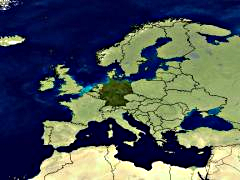
Bavaria – but also Germany - feature an increasing loss of land resources due to rapidly growing settlements and transport infrastructure. This development is strongly associated with an increase of impervious surface. Sealing of soil leads to an irreversible loss of its ecological, historical and economic functions. Moreover, evapotranspiration and infiltration capability are reduced. Particularly in urban environments this development is involved with the emergence of heat islands, the reduction of humidity and increased dustiness – effects that have negative influences on the local climate. Due to these effects the identification, characterization and monitoring of impervious surface is becoming a significant issue in environmental research and policy. Therefore, in 2006/07 we developed an objective, state-wide and spatially detailed survey of impervious surface by means of Support Vector machines (SVM) based on Landsat-7 imagery from the year 2000 and ATKIS vector data, where we calculated the
a) total of residential, industrial and transport areas, and
b) the area of impervious surface per head
for entire Bavaria and its administrative and landscape-related subdivisions. In this current study now we like to investigate the development of imperious surfaces in Bavaria between 2000 and 2015 based on Landsat OLI data.
The developed approach is based on a half-automatic method which uses techniques of digital image analysis on multispectral satellite data for the modelling of impervious surface. Therefore, high resolution satellite (e.g. Ikonos) or reference data is used to generate a model for the analysis the medium resolution Landsat imagery with its significantly larger surface coverage. The large spatial coverage of the Landsat scenes is the key issue to a low-cost mapping of extensive regions.
Publications:
Esch, T., Schorcht, G., Thiel, M. (2007): Satellitengestützte Erfassung der Bodenversiegelung in Bayern. Broschüre des Bayerischen Landesamts für Umwelt (Hrsg.). ISBN (Druck-Version): 978-3-940009-24-1, ISBN (Online-Version): 978-3-940009-25-8. Bayerisches Landesamt für Umwelt, Augsburg, 2007. 16 Seiten. (PDF)
Esch, T., Himmler, V., Schorcht, G., Thiel, M., Conrad, C., Wehrmann, T., Bachhofer, F., Schmidt, M., and Dech, S. (2009): Large-area assessment of impervious surface based on integrated analysis of single-date Landsat-7 images and geospatial vector data, Remote Sensing of Environment 113, 1678-1690.
Links:
Bayerisches Landesamt für Umwelt - Flächenmanagement
Contact: Dr. Michael Thiel

