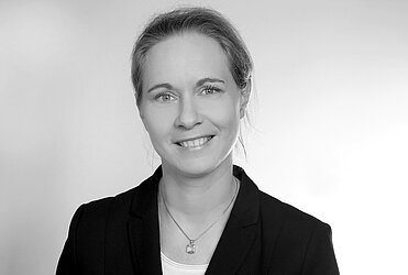
Prof. Dr. Claudia Künzer

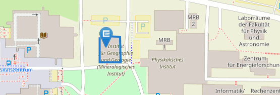
Department of Geography and Geology
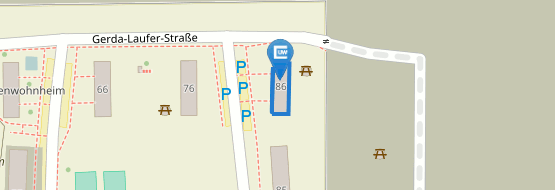
Oswald-Külpe-Weg 86
97074 Wuerzburg
Germany
c/o German Aerospace Center (DLR)
German Remote Sensing Data Center Oberpfaffenhofen
82234 Wessling, Germany
![]() +49 (0)8153 28-3280
+49 (0)8153 28-3280
![]() +49 (0)8153 28-1458
+49 (0)8153 28-1458
claudia.kuenzer@dlr.de
Thematic Focus:
-
Quantification of global change and land surface dynamics
-
Impacts of anthropogenic activities on terrestrial ecosystems and resources
-
Addressing socially relevant questions in the context of people and the environment
-
Influence of climate and environmental changes on human habitats
-
Adaptation strategies and policy recommendations
Methodological Focus:
-
Time series analysis (intra-annual, inter-annual, decadal, multi-decadal)
-
Complementary evaluation of multimodal, multi-sensor data (multispectral, radar, thermal, etc.)
-
Analysis of large remote sensing data archives and mass data processing
-
Deep learning and object extraction from very high-resolution Earth observation data
-
Large language models, transformers, and modeling
-
Synergies between natural and social sciences
Regional Focus:
-
Asia and Southeast Asia
-
Europe
-
Africa
-
Polar regions
01/2016 - heute
Erdbeobachtungszentrum, EOC, des Deutschen Zentrums für Luft- und Raumfahrt, DLR, Leitung der Abteilung ‘Dynamik der Landoberfläche’.
04/2010 - 12/2015
Erdbeobachtungszentrum, EOC, des Deutschen Zentrums für Luft- und Raumfahrt, DLR, Leitung der Arbeitsgruppe ‘Dynamik der Landoberfläche’.
01/2008 - 03/2010
Fernerkundungslehrstuhl, Institut für Geographie und Geologie, Julius-Maximilans-Universität Würzburg, Universitätsassistentin, Lehre in der Fernerkundung, Projektmanagement, Einwerbung von Drittmitteln
04/2006 - 01/2008
Technische Universität Wien, Institut für Photogrammetrie und Fernerkundung, IPF, Universitätsassistentin, Lehre in der Fernerkundung, Projektmanagement, Einwerbung von Drittmitteln
02/2005 - 06/2005
Beijing Normal University, BNU, China and Institute of Remote Sensing Applications, IRSA, China: Gastwissenschaftlerin (entsandt von DLR). Forschung in der Erdbeobachtung sowie Vorlesungen und Lehre.
07/2001 - 04/2006
Deutsches Fernerkundungsdatenzenrum, DFD, des Deutschen Zentrums für Luft- und Raumfahrt, DLR, Projekwissenschaftlerin und Projektkoordinationen, Analyse von multi-Sensor Satellitendaten
2016
Habilitation (venia legend) in Geographie an der Julius-Maximilans-Universität Würzburg: „The Potential of Earth Observation for the Sustainable Management of Natural Resources in Large River Delta Regions”
2005
Promotion (Dr. rer. nat.) in Fernerkundung an der Technischen Universität Wien, Institut für Photogrammetrie und Fernerkundung: “Demarcating Coal Fire Risk Areas based on Spectral Test Sequences and Partial Unmixing from Multisensor Remote Sensing Data
2001
Diplomarbeit am Parc Naturel de la Haute Sûre, Luxembourg,: Multitempolare Analyse der Landnutzung des ‚Parc Naturel de la Haute Sûre‘ mittels Fernerkundung und GIS mit Bezug zur Wasserqualität des Stausees Obersauer
2001
Diplom, Universität Trier, Angewandte Physische Geogaphie. Nebenfächer: Fernerkundung und Bodenkunde
1997 - 1998
Auslandsstudium an der Western Washington University, WWU, am ‘Huxley College of Environmental Science‘, Washington State, USA, Studienfokus: Fernerkundung, Bodenkunde, Klimawandel
1997
Vordiplom, Universität Trier, Angewandte Physische Geogaphie. Nebenfächer: Fernerkundung und Bodenkunde
1994
Abitur, Ernst-Kalkuhl Gymnasium Bonn


