
Training program in GIS and remote sensing for higher education in Uzbekistan (2011)
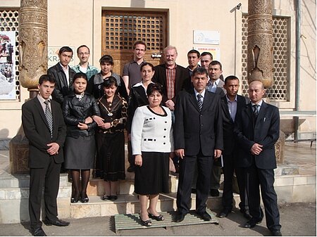
The State University of Urgench (UrDU) in Uzbekistan organized an advanced training in modern Geographic Information Systems (GIS) techniques and remote sensing (RS) methodology for its staff in Urgench from March 23 to April 1, 2011. This was the second “training of trainers” and a follow-up on the first and very successful training held at the University of Urgench in September 2010. The trainings are organized in cooperation with the ZEF/UNESCO project based in Urgench and the University of Wuerzburg, Germany.
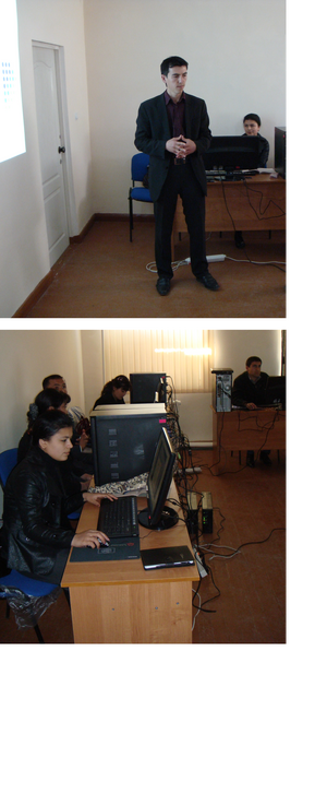
This workshop series on GIS and remote sensing technology fulfills an increasing demand by teachers in the region for being qualified in using and teaching GIS and remote sensing technology. Six of the eleven workshop participants, among them geographers, economists, and social scientists from the University of Urgench and the Agrarian University of Tashkent had already attended the introductory course in September 2010. This second course was now held in new facilities of the University of Urgench which were equipped with computers, technical devices and updated software funded by the German Ministry for Education and Research (BMBF). These facilities set the course for the University of Urgench to become a center of competence for GIS and remote sensing in Uzbekistan.
The second training course focused on remote sensing technologies and advanced applications within ecology, economics and agricultural sciences. Two scientists affiliated with the ZEF/UNESCO project, Gunther Schorcht and Fabian Loew (both from the University of Wuerzburg in Germany) combined theoretical lessons with practical exercises. A strong focus was put on small study projects to encourage the participants to apply and extend the learned lections in their own context.
The training was more complex than the first one in terms of enhancing knowledge and handling of remotely sensed satellite data in combination with GIS data. The participants integrated own data with freely available satellite data by using modern GIS software. After presenting their results, all participants received a certificate. The ZEF/UNESCO project in Urgench is a long-term scientific project that collaborates closely with local partners such as UrDU. The overall goal is to improve the use and management of natural resources in the region. Developing human and academic capacity, especially in modern and urgently needed remote sensing technology, is an important part of this German-Uzbek project.
Find more information here.
Outline of the course
Day 1:
- Repetition of the first course
- Introduction to Remote Sensing
- Applications of Remote Sensing
Day 2 + Day 3:
- ArcGIS10 – an Introduction
Day 4 + Day 5:
- Parameter
- Vegetation (phenology of cotton -> NDVI -> classification)
- Calculation of NDVI from Landsat images using RasterCalculator
- Outlook: yield, biomass, water stress
- Introduction to land cover classifications of satellite images
- Using NDVI to classify major land cover types in Khorezm using ArcGIS10 (mono-temporal and multi-temporal)
- Accuracy assessment
Day 6:
- Types of data and how to acquire data
- Using the personal geodatabase for data requests
- Downloading of Landsat data
- Introduction to advanced analysis of GIS and RS data using ArcGIS
- Using the Toolbox (distance analysis, interpolation, zonal statistics)
Day 7 – Day 9:
- Exercise: Optimal site selection: (finding the optimal location for a textile facility in Khorezm)
- Describing the basic data sets
- Reclassification, Weighting, Interpretation
- Creation of a map
Teaching material is available on request.

