GLOWA-Volta
The central objective of the GLOWA Volta Project (GVP) is the analysis of the physical and socio-economic determinants of the hydrological cycle in the Volta Basin in the face of global change. Based on this, the project aims at the establishment of a scientifically sound Decision Support System (DSS) for water resource management that has been adequately tested. The overall time frame envisaged for this is nine years. The project is part of the larger GLOWA Program financed by the Federal Ministry for Education and Research, with additional funding from the Ministry of Science and Research of North Rhine - Westphalia.
The decision support system (DSS) will provide a comprehensive monitoring and simulation framework enabling decision makers to evaluate the impact of manageable (irrigation, primary water use, land-use change, power generation, trans-boundary water allocation) and less manageable (climate change, rainfall variability, population pressure) factors on the social, economic, and biological productivity of water resources.
The watershed of the Volta River is one of the poorest areas of Africa. Despite the presence of some precious mineral resources, average annual income is estimated in the region at US $800 per year. For the majority of the population, rainfed and some irrigated agriculture is the backbone in the largely rural societies and the principle source of income. Population growth rates exceed 3%, placing increasing pressure on land and water resources.
Improved agricultural production in the West African savannah depends on the development of (near) surface water resources and their effective use. Such water development programs will have an impact on the availability of downstream water resources, in particular on those of the Volta Reservoir on which the urban population of Ghana depends for power generation.
The DLR University group in Wuerzburg in involved in the GVP land cover and land cover change module, that is the analyses of satellite derived land cover trajectories that are validated with independent socio-economic data driven by multi agent models (MAS). The cross verified change detection results will be implied in the hydrological budgeting estimates, to ascertain the effect of land cover change on the hydrological processes.
In this context we are using the FAO standard Land Cover Classification System legend and timely 30-meter Landsat and 15-30 resolution Aster ‘snap shots’ to map changes for the whole basin and also so for called change ‘hot spot’ areas, where rapid changes are expected. To augment the Landsat and ASTER data, we are also processing 250-500 MODIS near to daily overpass satellite data observations, that is variables form MODIS such reflectance, chlorophyll activity (or NDVI), and land surface ALBEDO.
The following satellite derived information layers of products are expected:
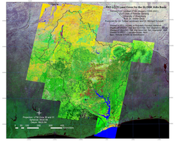
- LCCS 30-meter Landsat based LC data for 1990 and 2000/1, and for 2005/6 using 250-meter MODIS based decision tree LC classifications (whole basin)
- Validated LC change for the whole basin, based on LCCS codes
- LC change ‘hot spot’ analysis in NE Ghana from 1970-2001 (time steps 1970, 1984, 1990, 1994, 2001), validated using socio-economic data
- Carbon stock estimates and dynamics for GLOWA basin (PhD study)
Contact: l-geofernerkundung@uni-wuerzburg.de


