
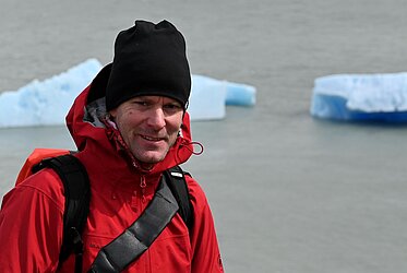
Dr. Martin Wegmann
Akademischer Oberrat am Lehrstuhl für Fernerkundung
Leitung Themenbereich Biodiversität und Naturschutz
EAGLE-Koordinator
![]() +49 (0)931 31-83446
+49 (0)931 31-83446
![]() +49 (0)931 31-834460
+49 (0)931 31-834460
martin.wegmann@uni-wuerzburg.de
Institut für Geographie und Geologie
Lehrstuhl für Fernerkundung
John Skilton Str. 4a
97074 Würzburg
nach Vereinbarung
seit 09/2011
Akademischer Rat auf Zeit
seit 2009
Lehrverantstaltungen im Elitestudiengang "Global Change Ecology" (www.bayceer.uni-bayreuth.de)
Link zur Lehre hier.
seit 04/2005
Wissenschaftlicher Mitarbeiter
ab 2017:
Akam. Rat auf Lebenszeit
seit 2016:
Lehrveranstaltungen im EAGLE Studiengang
seit 2013:
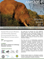
Lehrveranstaltungen in der AniMove Summerschool (und Gründer)
04/2005 - 07/2009
Promotion im Kontext der Analyse räumlicher Landschaftsattribute für biodiversitätsrelevante Fragestellungen u.a. im Rahmen des BIOTA-West Projekts (West Afrika)
2000 – 2004
Diplomarbeit im Bereich der Nutzung von fernerkundlichen Zeitreihen in Nordaustralien zur Erklärung von zoologischen Verteilungsmustern.
Hauptstudium in Biologie, Würzburg
Hauptfach: Tierökologie und Tropenbiologie
Nebenfach: Soziobiologie und Geographie
Spezialisierung in: Makroöcology, Biogeographie, Räuml. Statistik/Modelling, Geographische Informationssysteme (GIS) und Fernerkundung
1998 – 2000
Grundstudium in Biologie, Göttingen
Zeitschriftenbeiträge
-
. (2025): RStoolbox: An R package for remote sensing data analysis. In: Methods in Ecology and Evolution
-
. (2022): Detecting Moving Trucks on Roads Using Sentinel-2 Data. In: Remote Sensing, 14 (7), 1595.
-
. (2022): The Spectral Species Concept in Living Color. In: Journal of Geophysical Research: Biogeosciences, 127
-
. (2022): The Spectral Species Concept in Living Color. In: Journal of Geophysical Research: Biogeosciences, 127 (9)
-
. (2022): A Spectral Mixture Analysis and Landscape Metrics Based Framework for Monitoring Spatiotemporal Forest Cover Changes: A Case Study in Mato Grosso, Brazil. In: Remote Sensing, 14 (8)
-
. (2022): The Spectral Species Concept in Living Color. In: Journal of Geophysical Research: Biogeosciences, 127 (9), e2022JG007026.
-
. (2022): Biological Earth observation with animal sensors. In: Trends in Ecology & Evolution, 37 (4), 293-98.
-
. (2021): Quantifying the Response of German Forests to Drought Events via Satellite Imagery. In: Remote Sensing, 13 (9), 1845.
-
. (2021): Priority list of biodiversity metrics to observe from space. In: Nature Ecology and Evolution
-
. (2021): From local spectral species to global spectral communities: A benchmark for ecosystem diversity estimate by remote sensing. In: Ecological Informatics, 61, 101195.
-
. (2021): rasterdiv - an Information Theory tailored R package for measuring ecosystem heterogeneity from space: to the origin and back. In: Methods in Ecology and Evolution
-
. (2020): Over 150 Years of Change: Object-Oriented Analysis of Historical Land Cover in the Main River Catchment, Bavaria/Germany. In: Remote Sensing, 12 (24), 4048.
-
. (2020): moveVis: Animating movement trajectories in synchronicity with static or temporally dynamic environmental data in r. In: Methods in Ecology and Evolution
-
. (2019): rsMove – An R package to bridge Remote Sensing and Movement Ecology. In: Methods in Ecology and Evolution, 1-23.
-
. (2018): Free satellite data key to conservation. In: Science, Vol. 361 (Issue 6398), 139-40.
-
. (2018): Understanding Forest Health with Remote Sensing, Part III: Requirements for a Scalable Multi-Source Forest Health Monitoring Network Based on Data Science Approaches. In: Remote Sensing, 10 (7), 1-52.
-
. (2018): Understanding forest health with remote sensing -Part III - Requirements for a global multi-source forest health monitoring network. In: Remote SensingSpecial Issue "Remote Sensing of Forest Health", 10 (1120), 1-52.
-
. (2018): Satellite remote sensing of ecosystem functions: opportunities, challenges and way forward. In: Remote Sensing in Ecology and Conversation 2018, 4 (2), 71-93.
-
. (2018): Remotely sensed spatial heterogeneity as an exploratory tool for taxonomic and functional diversity study. In: Ecological Indicators, 85, 983-90.
-
. (2018): Measuring ß-diversity by remote sensing: A challenge for biodiversity monitoring. In: Methods in Ecology and Evolution, 9, 1787–1798.
-
. (2018): "Improving biodiversity monitoring using satellite remote sensing to provide solutions towards the 2020 conservation targets". In: Methods in Ecology and Evolution, 9 (8), 1784-86.
-
. (2017): Editorial: Remote Sensing in Ecology and Conservation: three years on. In: Remote Sensing in Ecology and Conservation, 3 (2), 53-56.
-
. (2017): Open data and open source for remote sensing training in ecology. In: Ecological Informatics, 40, 57-61.
-
. (2017): Building capacity in remote sensing for conservation: present and future challenges. In: Remote Sensing in Ecology and Conservation, 1-9.
-
. (2017): Remote Sensing in Ecology and Conservation: three years on. In: Remote Sensing in Ecology and Conservation, 3 (2), 53-56.
-
. (2017): Linking animal movement and remote sensing – mapping resource suitability from a remote sensing perspective. In: Remote Sensing in Ecology and Conservation
-
. (2017): Editorial: Remote Sensing Training in Ecology and Conservation – challenges and potential. In: Remote Sensing in Ecology and Conservation, 3 (1), 5-6.
-
. (2017): Protection status and national socio-economic context shape land conversion in and around a key transboundary protected area complex in West Africa. In: Remote Sensing in Ecology and Conservation
-
. (2017): r.pi: a GRASS GIS package for semi-automatic spatial pattern analysis of remotely sensed land cover data. In: Methods in Ecology and Evolution
-
. (2017): Conservation status of Asian elephants: the influence of habitat and governance. In: Biodiversity and Conservation, 1-5.
-
. (2017): Satellite remote sensing of ecosystem functions: opportunities, challenges and way forward. In: Remote Sensing in Ecology and Conservation, n/a-n/a.
-
. (2017): Measuring ß-diversity by remote sensing: A challenge for biodiversity monitoring. In: Methods in Ecology and Evolution, 9 (8), 1787-98.
-
. (2016): Mapping Bushmeat Hunting Pressure in Central Africa. In: Biotropica, 48 (3), 405-12.
-
. (2016): A frog’s eye view: logging roads buffer against further diversity loss. In: Frontiers in Ecology and the Environment, 14 (7), 353-55.
-
. (2016): The role of space agencies in remotely sensed essential biodiversity variables. In: Remote Sensing in Ecology and Conservation, 2 (3), 132-40.
-
. (2016): Temporal segmentation of animal trajectories informed by habitat use. In: Ecosphere, 7 (10), 1-16.
-
. (2016): Building capacity in remote sensing for conservation: present and future challenges. In: Remote Sensing in Ecology and Conservation
-
. (2016): Framing the concept of satellite remote sensing essential biodiversity variables: challenges and future directions. In: Remote Sensing in Ecology and Conservation
-
. (2015): Modeling and Validation of Environmental Suitability for Schistosomiasis Transmission Using Remote Sensinged. by Justin V. Remais. In: {PLoS} Negl Trop Dis, 9 (11), e0004217.
-
. (2015): Environmental science: Agree on biodiversity metrics to track from space. In: Nature, 523 (7561), 403.
-
. (2015): Risk profiling of schistosomiasis using remote sensing: approaches, challenges and outlook. In: Parasites Vectors, 8 (1)
-
. (2015): Disentangling the relative effects of bushmeat availability on human nutrition in central Africa. In: NATURE, Scientific Reports 5
-
. (2015): Free and open-access satellite data are key to biodiversity conservation. In: Biological Conservation, 182, 173-76.
-
. (2015): Free and open-access satellite data are key to biodiversity conservation. In: Biological Conservation, 182, 173-76.
-
. (2015): Will remote sensing shape the next generation of species distribution models?. In: Remote Sensing in Ecology and Conservation, 1 (1), 4-18.
-
. (2015): Capability of Spaceborne Hyperspectral EnMAP Mission for Mapping Fractional Cover for Soil Erosion Modeling. In: Remote Sensing, 7 (9), 11776.
-
. (2015): Satellite remote sensing to monitor species diversity: potential and pitfalls. In: Remote Sensing in Ecology and Conservation
-
. (2015): The Role of Vegetation in Mitigating Urban Land Surface Temperatures: A Case Study of Munich, Germany during the Warm Season. In: Sustainability, 7 (4), 4689.
-
. (2015): Advancing terrestrial conservation through remote sensing. In: Ecological Informatics, 30, 318-21.
-
. (2015): Use of an ecologically relevant modelling approach to improve remote sensing-based schistosomiasis risk profiling. In: Geospatial Health, 10 (2)
-
. (2015): Flood exposure and settlement expansion since pre-industrial times in 1850 until 2011 in north Bavaria, Germany. In: Regional Environmental Change, 15 (1), 183-93.
-
. (2014): Satellite remote sensing for applied ecologists: opportunities and challenges. In: Journal of Applied Ecology, 51 (4), 839-48.
-
. (2014): Ten Ways Remote Sensing Can Contribute to Conservation. In: Conservation Biology
-
. (2014): Adding structure to land cover - using fractional cover to study animal habitat use. In: Movement Ecology, 2 (26)
-
. (2014): Oil in the Sahara: mapping anthropogenic threats to Saharan biodiversity from space. In: Philosophical Transactions of the Royal Society B: Biological Sciences, 369 (1643)
-
. (2014): Mapping threatened dry deciduous dipterocarp forest in South-east Asia for conservation management. In: Tropical Conservation Science, 7 (4), 597-613.
-
. (2014): Earth observation satellite sensors for biodiversity monitoring: potentials and bottlenecks. In: International Journal of Remote Sensing, 35 (18), 6599-6647.
-
. (2014): Role of African protected areas in maintaining connectivity for large mammals. In: Philosophical Transactions of the Royal Society B: Biological Sciences, 369 (1643)
-
. (2014): The application of remote sensing for marine protected area management. In: Ecological Indicators, 36, 169-77.
-
. (2013): Satellites: make data freely accessible. In: Nature, 498 (37), 37.
-
. (2013): Essential Biodiversity Variables. In: Science, 339 (6117), 277-78.
-
. (2012): Home on the range: factors explaining partial migration of African buffalo in a tropical environment.. In: PLOS One, 7 (5)
-
. (2012): Quantifying and Mapping Ecosystem Services Supplies and Demands: A Review of Remote Sensing Applications. In: Journal of Environmental Science and Technology, 46 (16), 8529-41.
-
. (2012): Factors affecting intraspecific variation in home range size of a large African herbivore.. In: Landscape Ecology, 27 (10), 1523-34.
-
. (2012): Modelling Forest alpha-Diversity and Floristic Composition - On the Added Value of LiDAR plus Hyperspectral Remote Sensing. In: Remote Sensing, 4, 2818-45.
-
. (2011): Evolution of water quality around the Island of Borneo during the last 8-years.. In: Procedia Environmental Sciences.
-
. (2011): Measuring landscape heterogeneity by remotely-sensed spectral variability in an Open Source space.. In: Ecological Informatics.
-
. (2011): A hotspot revisited - a biogeographical analysis of West African amphibians. In: Diversity and Distributions, 1-12.
-
. (2011): Assessing effects of temporal compositing and varying observation periods for large-area land-cover mapping in semi-arid ecosystems: Implications for global monitoring. In: Remote Sensing of Environment, 115 (10), 2445-59.
-
. (2009): Urbanization in India – Spatiotemporal analysis using remote sensing data. In: Computers, Environment and Urban Systems, 33 (3), 179-88.
-
. (2008): Flying high - assessing the use of the aerosphere by bats. In: Integrative and Comparative Biology, 48, 60-73.
Bücher
-
. (2020): An Introduction to Spatial Data Analysis
-
. (2016): Remote Sensing and GIS for Ecologists: Using Open Source Softwarehg. von M. Wegmann, B. Leutner, und S. Dech
Buchbeiträge
-
. (2016): Monitoring protected areas from space. In: Protected areas: are they safeguarding biodiversity?
-
. (2015): Chapter 2: Fundamentals of Remote Sensing for Terrestrial Applications: Evolution, Current State of the Art, and Future Possibilities. In: Remotely sensing handbook. Volume I
-
. (2010): Fragmentation of rain forest - endangering biodiversity. In: Biodiversity Atlas of West Africa, Volume II: Burkina Fasopages, 86-91.
-
. (2009): Systematic Assessment of Forest Cover Change and Forest Fragmentation in Indian Sub-Continent using Multi-Scale Satellite Remote Sensing Inputs. In: Geoinformatics for Natural Resource Management
Konferenzbeiträge
-
. (2017): Towards Behavior Dependent Species Distribution Modeling. In: 37th International Symposium of Remote Sensing of Environmentpage, 473.
-
. (2017): Habitat Use of Migratory Birds: Movement Ecology Meets Remote Sensing. In: 37th International Symposium on Remote Sensing of Environment
-
. (2017): Habitat use during spring migration: Remote sensing meets movement ecology. In: 6th International Bio-Logging Science Symposium
-
. (2017): Habitat use of migratory birds: movement ecology meets remote sensing. In: 37th International Symposium on Remote Sensing of Environment
-
. (2016): Langzeit-Erdbeobachtungsdaten für die Analyse globaler Veränderungen. In: Leopoldina Symposium Erdbeobachtung durch Tiere – Chancen und Perspektiven
-
. (2016): Remote Sensing in Movement Ecology: Scale Dependencies of Space Use. In: Living Planet Symposium - Europen Space Agency (ESA)
-
. (2016): Remote sensing in ecology and conservation. In: ESA Living Planet Symposium
-
. (2016): Laboratory for Essential Biodiversity Variables (EBV) Concepts – The “Data Pool Initiative for the Bohemian Forest Ecosystem”. In: Living Planet Symposium 2016
-
. (2016): Moving remote sensing towards application. In: Space – the final frontier for biodiversity monitoring
-
. (2016): Remote Sensing in Ecology and Conservation. In: Institute for Zoo and Wildlife Research
-
. (2015): Sensor requirements for biodiversity research. The role of spatial and spectral resolution in mapping habitat of zoological communities. In: The 36th International Symposium on Remote Sensing of Environment
-
. (2014): Modelling forest habitat of zoological communities - Which sensors do we actually need?. In: 34th EARSeL Symposium European remote sensing - new opportunities for science and practicepage, 380.
-
. (2014): The Global Urban Footprint - A new worldwide human settlements layer to assess anthropogenic disturbances. In: ZSL Symposium on Remote Sensing for Conservation
-
. (2014): Combining land cover change and fragmentation analyses to track habitat degradation. In: Symposium "Remote Sensing for Conservation"
-
. (2014): How much is enough? Habitat mapping and the need for hyper-resolution. In: 44th annual meeting of the Ecological Society of Germany, Austria and Switzerland: Integrating ecological knowledge into nature conservation and ecosystem management
-
. (2013): Unifying Conservation and Remote Sensing approaches. In: ICCB - International Congress for Conservation Biology
-
. (2013): Biodiversity activities within the Committee of Earth Observation Satellites (CEOS). In: Committee of Earth Observation Satellites (CEOS)
-
. (2012): Transmission of Schistosomiasis in Africa and its vulnerability to climate change. In: 32. Internationaler Geographischer Kongress in Köln
-
. (2012): Automatic population counts for improved wildlife management using aerial photography. In: IEMSs Proceedings 2012pages, 1-8.
-
. (2012): Schistosomiasis risk assessment from space using high resolution Rapid Eye data. In: IEEE Geoscience and Remote Sensing Symposium - Remote Sensing for a Dynamic Earth, 22-27 Jul 2012pages, 7224-27.
-
. (2012): Beitrag von hochaufgelösten Rapid Eye Daten zur Räumlichen Risikoanalyse in der Gesundheitsforschung am Beispiel von Schistosomiasis. In: Proceedings 4. RESA Nutzerworkshop, DLR Rapid Eye Science Archive (RESA), DLR Neustrelitz, pp. 325-332
-
. (2011): Sprawling Crisis? Exploring the Crossroads of Urban Growth and Natural Environments with Earth Observation. In: 34th International Symposium for remote Sensing of the Environment
-
. (2011): Remote Sensing based estimation of potential terrestrial carbon stocks in West Africa.. In: 34rd International Symposium on Remote Sensing of Environment
-
. (2011): Spatio-temporal cross-city comparison using multisensoral remote sensing for Mexican cities. In: Proceedings of JURSE2011pages, 81-84.
-
. (2011): Robustness and Constraints on Spatial Transferability of Fractional Cover in the Caprivi, Namibia.. In: Proceedings of the 34th International Symposium on Remote Sensing of Environment, 10.-15. April 2011, Sydney, Australien. ISRSE 2011, 10.-15. Apr. 2011, Sydney, Australia
-
. (2011): Sprawling Crisis? Exploring the Crossroads of Urban Growth and Natural Environments with Earth Observation.. In: Proceedings of the 34th International Symposium on Remote Sensing of Environment, 10.-15. April 2011, Sydney, Australien. ISRSE 2011, 10.-15. Apr. 2011, Sydney, Australia
-
. (2011): Bushmeat harvest at the nexus of socio-economics and habitat.. In: Status and future of tropical biodiversity - BIODIVERSITY SCIENCE & POLICY, 21.-24.02.2011, Frankfurt, Deutschland
-
. (2011): Modelling Biodiversity and Forest Structure Using Hyperspectral and LIDAR Remote Sensing. In: 41st Annual Meeting of the Ecological Society of Germany, Austria and Switzerland (GFÖ), 05.09.2011 – 09.09.2011, Oldenburg, Germany
-
. (2011): Disease Risk Assessment from Space: Case Study of Human Schistosomiasis. In: Workshop "Biodiversität und Infektionskrankheiten" (DIVERSITAS Deutschland e.V.) vom 28.11.2011 - 29.11.2011 in Frankfurt, Poster
-
. (2011): Multi-sensor-concepts for the assessment of land surface phenology using remote sensing data.. In: PhenoALP project final meeting, 12.-14.Oct. 2011, Torgnon, Italy
-
. (2011): Land Use Change Affects Coastal Water Quality around Borneo.. In: Proceedings of the 34th International Symposium on Remote Sensing of Environment, 10.-15. April 2011, Sydney, Australien. ISRSE 2011, 10.-15. Apr. 2011, Sydney, Australia
-
. (2010): The capabilities of remote sensing to derive urban location factors for probability-based spatial growth analysis. In: 15th International Conference on Urban Planning, Regional Development and Information Society (REAL CORP)
-
. (2010): The global trend of urbanization - Spatiotemporal analysis of megacities using multitemporal remote sensing, landscape metrics and gradient analysis. In: Proceedings of SPIE Europe Remote Sensingpages, 1-20.
-
. (2009): Adding spatial attributes to landcover data – an ecological perspective. In: Proceedings of the 2009 IEEE International Geoscience and Remote Sensing Symposium
-
. (2009): Analysis of urban sprawl at mega city Cairo, Egypt using multisensoral remote sensing data, landscape metrics and gradient analysis. In: 33rd International Symposium on Remote Sensing of Environment
-
. (2009): Urbanization: A global change issue. In: 33rd International Symposium on Remote Sensing of Environment
-
. (2009): Analysis of Spatial Patterns – adding attributes to Forest Patches to Evaluate the Importance of Individual Fragments for Spatial Landscape Integrity. In: 33rd International Symposium on Remote Sensing of Environment
-
. (2008): Spatiotemporal analysis of Indian megacities. In: Proceedings of the International Archives of the Photogrammetry, Remote Sensing and Spatial Information Sciences, 75-82.
-
. (2006): Spatial modelling of changes of the distribution of tree species with Landsat satellite data in Benin. In: 6th International Conference of the African Association of Remote Sensing of the Environment (AARSE)
-
. (2006): Satellite derived spatial and temporal distribution of fire activity in subsahelian West Africa. In: 6th International Conference of the African Association of Remote Sensing of the Environment (AARSE)
-
. (2006): Spatio-temporal analysis of African landscapes for biodiversity research. In: 6th International Conference of the African Association of Remote Sensing of the Environment (AARSE)
-
. (2005): Land Cover Change in Southern and Western Africa - A combined Change Detection Approach. In: 2005 Conference on Remote Sensing and Geoinformation
Alexandra Bell
"Application of behavioural change point analysis and species distribution models in Conservation
Andrea Früh
Historic changes in regional ecosystem service demand: The impact of settlement change on flood mitigation in the upper Main basin.
Anne Simang
Influence of habitat and governance for landscape level conservation on Asian elephants.
Benjamin Leutner
Modelling biodiversity patterns in a temperate montane forest by means of hyperspectral & LiDAR remote sensing
Carlos Dambros
Analysing forest fragmentation characteristics along continuous vegetation gradients.
Christian Wohlfahrt
Mapping tropical dry forest in South East Asia using a continuous cover approach.
Christiane Plum
Global survey of Earth Observation for Biodiversity and Conservation.
Daniel Kachelriess
Analysis of the effectivity of Marine Protected Areas – a case study using Remote Sensing for the Chargos Archipel.
Daniela Braun
Estimating the current and future human impact in Tanzania for wildlife corridor management.
Daniela Kretz
Frost in a warmer world: spatio-temporal investigation of the recovery of temperate forests after a late spring frost.
Eva Obermaier
Impact of Environmental Factors on Geographical Schistosomiasis Distribution in the Man Region of Ivory Coast.
Hannes Müller
Modeling of Forest Structure with Remote Sensing Data.
Judith Reise
Impact on model algorithm selection and remote sensing data selection on the analysis of species-habitat associations and the prediction of species distribution: A case study using camera trap data of dhole and leopard in Cambodia.
Michael Ewald
Assessing the Influence of Vegetation Structure on Roe Deer (Capreolus capreolus) Habitat Selection Using Airborne LiDAR
Sadra Alavi
Analysing urban spatial patterns in conjunction with urban heat patterns
Tim Besser
Sprawling crisis? Urbanization from the perspective of protected areas near Kolkata, India.
mentored Diploma theses:
Stefanie Jacob
Die Jagd im Kontext von Sozioökonomie- und Habitatveränderungen. Eine räumliche Analyse der bushmeat-Entnahme in Zentralafrika
Maximilian Reinwand
Untersuchung der Vegetationsdegradation in den Savannen des südafrikanischen Hochplateaus.
- http://remote-sensing-biodiversity.org/
- http://www.animove.org
- http://remote-sensing-conservation.org/
- http://remote-sensing.eu/author/martin/
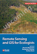
Upcoming book: Remote Sensing and GIS for Ecologists
weitere Informationen:
http://remote-sensing-biodiversity.org/rsecology-book
jointly with MPI, ZSL and Smithsonian

