Dr. Mirjana Bevanda

Lehrstuhl für Fernerkundung
![]() +49 (0)931 31-87644
+49 (0)931 31-87644
![]() +49 (0)931 31-876440
+49 (0)931 31-876440
mirjana.bevanda@uni-wuerzburg.de
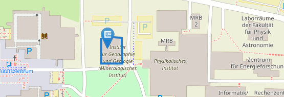
Institut für Geographie und Geologie
Lehrstuhl für Fernerkundung
John Skilton Str. 4a
97074 Würzburg
nach Vereinbarung
ab 2020:
PostDoc im EcoGlob Projekt. Forschung für die ökologische Anwendung
bis 2020:
PostDoc in WASCAL DE COOP 'West Africa Science Service Center on Climate Change and Adapted Land Use', gefördert durch das Bundesministerium für Bildung und Forschung (BMBF; FKZ 01LG1808A)
Forschungsschwerpunkte und Interessen:
Landschaftsökologie, räumliche Datenanalysen, GIS und Fernerkundung, ökologische Modellierung, Bewegunsmusteranalysen von Tieren, Biodiversitätsmuster, Naturschutz
2015
Promotion an der Universiät Bayreuth. Thema: "Animals in space and time: spatio-temporal movement pattern analysis"
2008
Diplom. Thema: "Räumlich-statistische Analysen der Habitatpräferenzen und Verbreitungsmuster von Paarhufern (Artiodactyla) im Pfälzer Wald."
2002 - 2007
Studium der Biologie an der Phillips Universität Marbung und der Julius Maximilians Universität Würzburg mit den Hauptfächern Tierökologie und Tropenbiologie
Zeitschriftenbeiträge
-
. (2026): Automized segmentation of animal paths in UAS Imagery using deep learning - a case study from the Kruger National Park. In: Ecological Informatics, 93, 103570.
-
. (2016): Bridging disciplines with training in remote sensing for animal movement: an attendee perspective. In: Remote Sensing in Ecology and Conservation
-
. (2015): Landscape configuration is a major determinant of home range size variation. In: Ecosphere
-
. (2014): Role of African protected areas in maintaining connectivity for large mammals. In: Philosophical Transactions of the Royal Society B: Biological Sciences, 369 (1643), 20130193.
-
. (2014): Adding structure to land cover – using fractional cover to study animal habitat use. In: Movement Ecology
Buchbeiträge
-
. (2016): Introduction to the added value of Animal Movement Analysis and Remote Sensing in book: Remote Sensing and GIS for Ecologists: Using Open Source Software
-
. (2016): Spatial Data Analysis for Ecologists: Fist Steps In book: Remote Sensing and GIS for Ecologists: Using Open Source Software
-
. (2016): Continuous Land Cover Information. In book: Remote Sensing and GIS for Ecologists: Using Open Source Software.
-
. (2016): Spatial Land Cover Pattern Analysis in book: Remote Sensing and GIS for Ecologists: Using Open Source Software


