Marius Philipp, M.Sc.

Lehrstuhl für Fernerkundung
![]()
![]()
marius.philipp@uni-wuerzburg.de
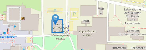
Institut für Geographie und Geologie
Lehrstuhl für Fernerkundung
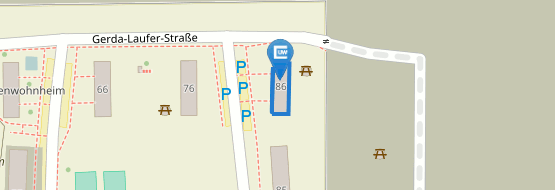
Oswald-Külpe-Weg 86
97074 Würzburg
Cambus Hubland Nord
Gebäude 86
Zimmer 1.004
nach Vereinbarung
Doktorand am Lehrstuhl für Fernerkundung.
Professional Experience:
since 02/2020
Julius Maximilians-Unversity of Würzburg
Doctoral Student
11/2019 – 01/2020
Julius Maximilians-Unversity of Würzburg
Research Assistant
04/2018 – 09/2019
Julius Maximilians-Unversity of Würzburg
Student Assistant Researcher
01 – 03/2019
Remote Sensing Solutions (RSS) GmbH, München
Intern
09 – 10/2018
Commonwealth Scientific and Industrial Research Organization (CSIRO), Darwin/Australien
Intern
04 – 05/2017
German Aerospace Center (DLR), Oberpfaffenhofen
Intern at the German Remote Sensing Data Center (DFD), Department Land Surface
Academic Career and Education:
10/2017 – 11/2019
Julius-Maximilians-University of Würzburg
Applied Earth Observation and Geoanalysis of the Living Environment (EAGLE), Master of Science (M.Sc.)
10/2013 – 09/2017
Julius-Maximilians-University of Würzburg
Geography (main subject) combined with Biology (side subject), Bachelor of Science (B.Sc.)
09/2005 – 06/2013
Johann-Michael-Sailer Gymnasium, Dillingen a.d. Donau
General University Entrance Qualification
-
. (2023): A Circum-Arctic Monitoring Framework for Quantifying Annual Erosion Rates of Permafrost Coasts. In: Remote Sensing, 15 (3), 818.
-
. (2022): Automated Extraction of Annual Erosion Rates for Arctic Permafrost Coasts Using Sentinel-1, Deep Learning, and Change Vector Analysis. In: Remote Sensing, 14 (15), 3656.
-
. (2021): Quantifying the Response of German Forests to Drought Events via Satellite Imagery. In: Remote Sensing, 13 (9), 1845.
-
. (2021): Trends in Satellite Earth Observation for Permafrost Related Analyses - A Review. In: Remote Sensing, 13 (6), 1217.
-
. (2021): Trends in Satellite Earth Observation for Permafrost Related Analyses—A Review. In: Remote Sensing, 13 (6)
-
. (2019): Exploring the Potential of C-Band {SAR} in Contributing to Burn Severity Mapping in Tropical Savanna. In: Remote Sensing, 12 (1), 49.
-
. (2021): Africa’s Protected Natural Assets: The Importance of Conservation Areas for Prosperous and Resilient Societies in Africa.
-
. (2022): Towards the global Quantification of Permafrost Loss along Arctic Coasts. In: ESA Living Planet Symposium 2022


