A 3D Model for the Blaueis Valley
09/30/2025Climate change is making mountains more dangerous. 3D models help to identify changes in these landscapes and recognise dangers earlier. A team from the University of Würzburg has created one for the Blaueis Valley in the Alps.
Climate change is altering high mountain regions worldwide. As temperatures rise, natural hazards such as rockfalls, rockslides and landslides are increasing significantly. This also increases the risk for visitors. The effects of climate change are already being felt in the Berchtesgaden Alps.
In the summer of 2025, a research team from Julius-Maximilians-Universität Würzburg (JMU) created a high-resolution, digital 3D model of the Blaueis Valley - named after the glacier located there. The Chair of Geomorphology, headed by Professor Georg Stauch, cooperated with Professor Birgit Terhorst's Physical Geography and Soil Science working group.
"Our model allows us to recognise the smallest changes in the surface structure of the valley in the future," says Stauch. In this way, the researchers are contributing to an even better understanding of Alpine landscape development and the ability to assess the risks associated with climate change.
Five Billion Measuring Points in the 3D Model
To create the model, the team used terrestrial laser scanners (TLS for short) on site. This scanning method makes it possible to capture terrain surfaces and visualise them in a high-resolution 3D model. The method is well suited to areas that are difficult to access, such as steep faces, scree slopes and glacier forefields. "Data collection works safely and quickly with laser scans of this kind, as they can cover a wide area," explains the geography professor. This means that dangerous sections of the valley can be avoided.
The accuracy of the survey is due to the high number and density of measurements: "Our 3D model consists of a total of five billion measuring points," says Stauch. This leads to a detailed image of the valley floor and the surrounding slopes.
Further measurements are to be carried out in the coming years - the next one in summer 2026. "This will allow us to refine the model and document the changes in the landscape," says the JMU scientist. Danger zones could then also be identified at an early stage - including rocky regions with an increased risk of rockfalls.
Contact
Prof. Dr Georg Stauch, Head of the Chair of Geomorphology, T. +49 931 31-84714, georg.stauch@uni-wuerzburg.de
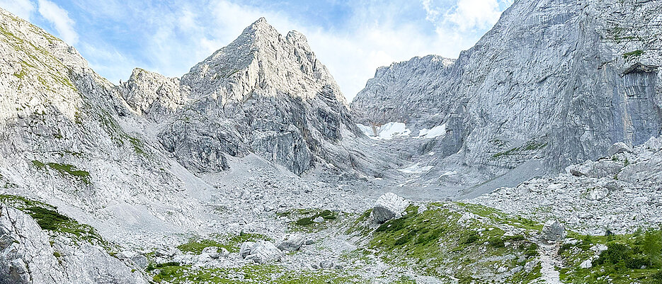
About the Blue Ice Glacier
The Blaueis Glacier in the Berchtesgaden National Park is one of only four glaciers in Germany and the northernmost in the Alps. It is nestled between the mountain faces of the Blaueisspitze (2480 metres), the Hochkalter (2607 metres) and the Kleinkalter (2513 metres). The glacier has been retreating rapidly for decades as a result of the continuing rise in temperatures. Today, the Blaueis Valley and its rock faces are characterised by a large number of active mass movements such as rockfalls and rockslides.
Additional images
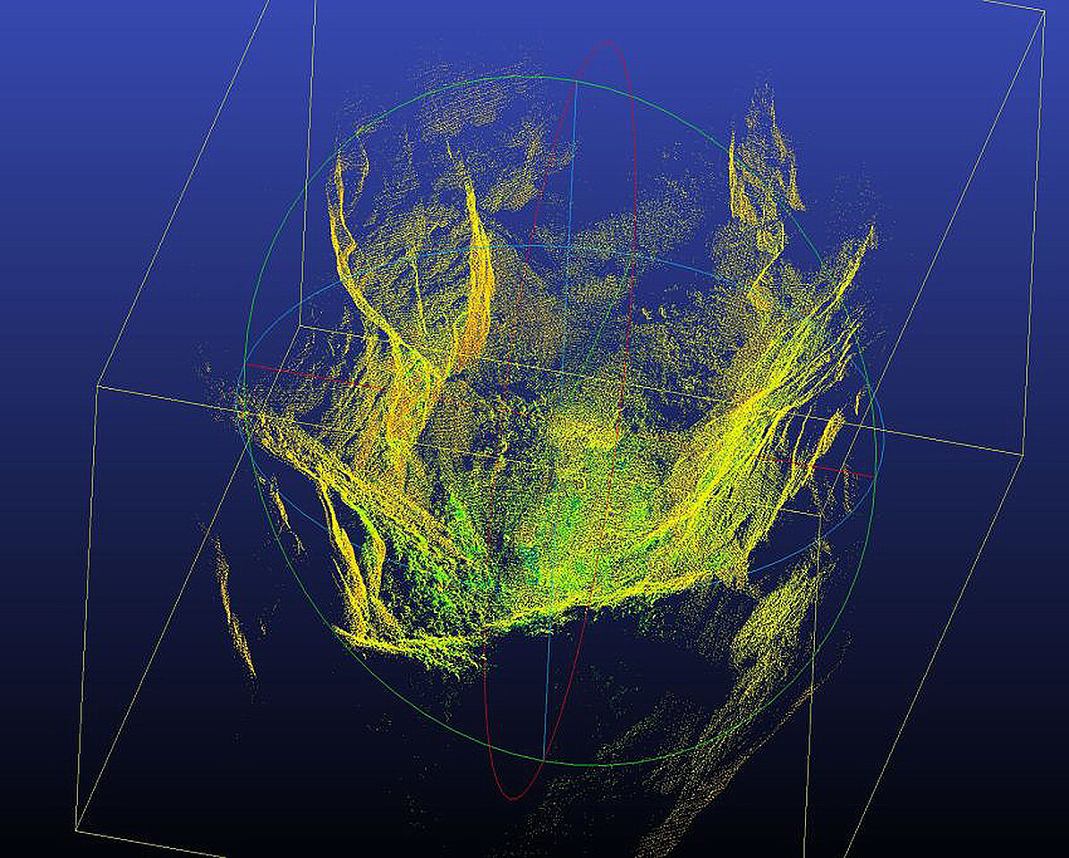
The 3D model of the valley consists of five billion data points. (Image: Georg Stauch / Universität Würzburg)
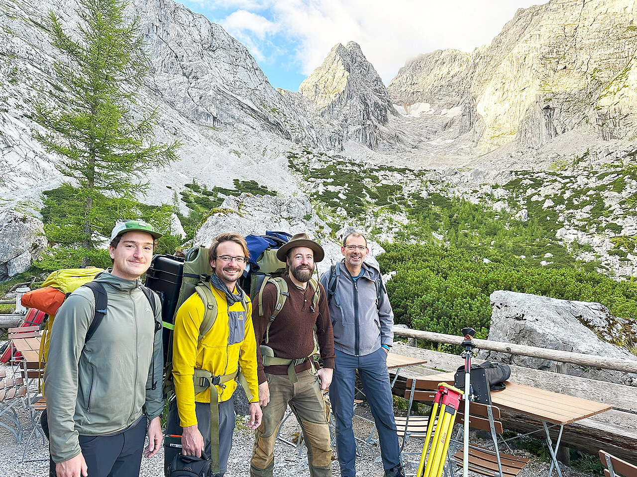
The team conducting field research in the Blaueis Valley in the summer of 2025 (from left): Niklas Grimm, Janek Walk, Christian Büdel, and Georg Stauch. (Image: Georg Stauch / Universität Würzburg)

