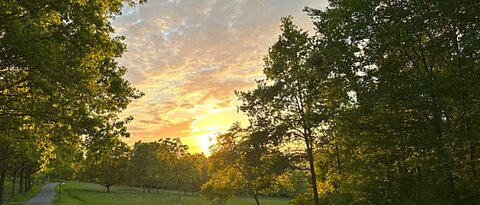
Deutsch Intern
  • [Translate to Englisch:] Studium
Institute of Geography and Geology

Detailed Information for the M.Sc. GEOSPHERES

Mandatory Courses

Mandatory courses are attended by all students. They provide an overview of the different topics covered by the the GEOSPHERES master program.

Environmental challenges I

The lecture course provides knowledge on the geozones as well as on geographical hotspots of the Earth. In terms of teaching the overarching goal comprises a combination of basic and applied presentations. Environmental factors such as soils, climate, geomorphology, and geology play a major role in form of a complex natural structure within the specific geozones. Furthermore, the lecture focuses on the connection between natural geofactors and human-environmental relationships.

[1. Semester; 5 ECTS]

Environmental challenges II

The lecture course presents case studies on applied physical-geographic key issues. The overarching teaching objectives focus on the complexity of environmental developments, further considering specific environmental conditions as well as interactions between climate-, soil- and landscape changes, geodynamics and georisks. The scientific topics are related to the field of tension between natural processes and their interplay with the consequences of anthropogenic impact.

[2. Semester; 5 ECTS]

Discussing current topics in environmental research

The seminar focuses on current issues in the environmental and geosciences. The students prepare the topics in groups and present them to the participants from different perspectives, both pro and con. They then moderate an open discussion on the topic among all those present.

[3. Semester; 5 ECTS]

Applied project

The applied project combines aspects of geoscientific problem analysis, organisation of appropriate work plans and methods as well as data analysis. It prepares for the independent project development, conduction of analyses and finalisation of geoscientific problem-solving projects in various thematic focus areas. Students can choose their own focus area based on the combination of the various core areas, e.g., geomorphology, climatology, soil science or geology. The data acquired in the course of the applied project can be used for the preparation of a comprehensive final report in the form of a Master’s thesis.

[3. Semester; 10 ECTS]

Methods

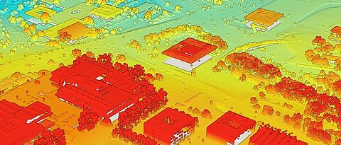
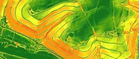
In the methods section you will aquire advanced methods for interpreting geospatial data, gaining the skills to analyze complex spatial patterns and derive meaningful insights from geographic information.

Applied statistics in geosciences

In the module, common and special methods of univariate and multivariate statistics are implemented on the computer with the help of the programming environment R, using catchy examples from the various fields of geography.

[1. Semester; 5 ECTS]

Scientific writing and presenting

Instruction in the preparation of geoscientific manuscripts and reports following internationally recognized rules, specifically in the acquisition of scientific information, correct citation and handling of copyright issues, as well as in the preparation of oral presentations.

[1. Semester; 5 ECTS]

Advanced GIS & geoinformatics

The module offers a comprehensive introduction to advanced techniques for analysing and cartographically presenting spatial and temporal data. It also covers fundamental programming principles for geospatial and geostatistical analysis, particularly at the interface with GIS. Additionally, it provides a foundational overview of geodata management in accordance with the FAIR principles. Emphasis is placed on applications relevant to physio-geographical objectives, utilizing environmental geodata.

[2. Semester; 5 ECTS]

Elective Modules

The elective module area allows students to choose from a range of specialized courses, enabling them to tailor their studies according to their individual interests.

You have to choose 3 out of 8 courses in your first and another set of 3 in your second semester.

Each course carries 5 ECTS credits.

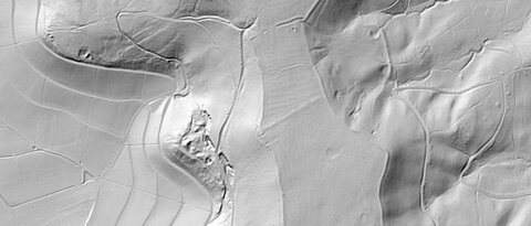
Focus area Geomorphology

Earth surface processes and landforms in a changing world

This module explores the dynamic interactions that shape the Earth's surface under changing environmental conditions. It also provides essential geomorphological methods to study Earth surface processes and their effects on landforms over a wide range of spatial scales. The course will provide an in-depth understanding of geomorphological processes, the measurement of landscape change and the interpretation of spatial and temporal environmental data.

Human-environmental interactions

There is a complex relationship between humans and their environment through time. This module focuses on how landscapes and especially landscape changes shape human societies and how human activities, in turn, modify landscapes. The module integrates concepts from geoarchaeology and environmental science to explore past, present, and future inherent interrelations between humans and environment.

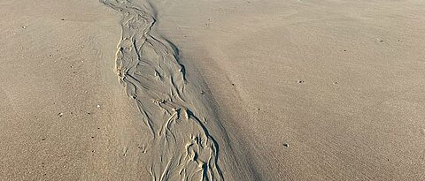
Natural risks and hazards

In a changing world, the risks of natural hazards affecting societies are rapidly increasing. This module deals with the fundamentals of natural hazards, vulnerability, risks and disasters in a global context. Different concepts and applied methods for disaster risk assessment and adapted mitigation measures are introduced by a variety of practical case studies covering a wide range of hazards from different geomorphic process domains. Advanced topics cover the complexity of multiple hazards and cascading effects.

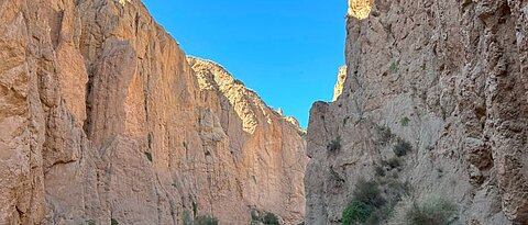
Landscape dynamics in the Anthropocene

Humans have been exerting a significant influence on the landscape for thousands of years. Since the beginning of industrialization, and especially since the mid-20th century, this influence has intensified globally, and humans have become the dominant driver for landscape changes. Through instrumental setups as well as modelling approaches, the multifaceted ways in which anthropogenic actions alter geomorphic processes and landforms are explored. This module especially focuses on changes in the past 100 years and possible future developments.

Focus area Climate

Man-made climate change, implications and mitigation

The module focuses on the variability of atmospheric conditions on the climatological time scale. The anthropogenic influence on the earth's climate system is assessed against the background of natural climate factors and fluctuations. Observed climate change indicators and climate model results are presented, as well as their ecological and socio-economic consequences. Approaches, problems and successes of climate protection are discussed.

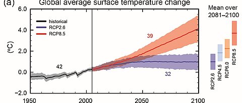
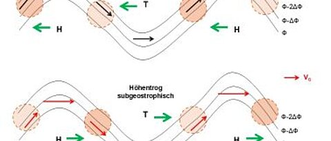
Weather phenomena in the mid-latitudes

The focus is on the variability of atmospheric conditions in the mid-latitudes on the meteorological time scale from hours to days. The module deals with synoptic meteorology, i.e. the physical and mathematical description of weather events and numerical weather forecasting. In-depth insights into the basic physical equations and their mathematical derivation are provided.

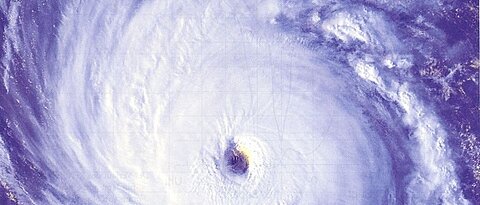
Meteorological and climate hazards and their management

The module deals with the causal processes, the appearance, the history and the effects of extreme events in the fields of meteorology, hydrology and social systems. Extreme value statistics as a means of scientifically assessing extreme events is also addressed.

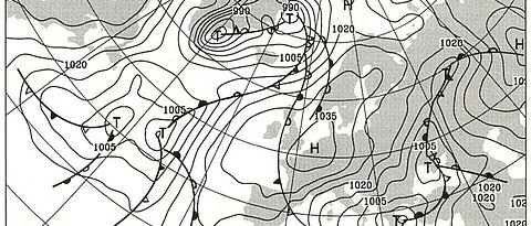
Measuring and forecasting of weather in the mid-latitudes

The module deals with the phenomenology of weather systems in the mid-latitudes and introduces hand formulas in weather forecasting. The students prepare a weekly weather briefing that illustrates the theoretical principles taught. Furthermore, students work in groups to carry out independent meteorological field measurements in the Würzburg area, for which they develop their own measurement design.

Focus area Soil Science

Soils in a changing environment

The lecture course highlights the role and the relevance of soils and landscapes within their natural and cultural environment. Spatio-temporal aspects of the different soil functions will be presented, evaluated, and discussed. Causes and dynamics of soil formation and surface processes as well as the appearance of specific soil groups related to selected geomorphological landforms build the core topics.

Soil dynamics and natural hazards

The students gain knowledge on the assessment of the surface-near underground with its meaning for natural hazards, soil degradation, and human land-use. Applied case studies, landscape analysis, and environmental problems are in the center of interest of the student’s work. The seminar combines theoretical and/or laboratory- as well as field analysis in order to consolidate methodological expertise.

Analytical methods in soil and environmental studies

The course aims at sharing basic knowledge on laboratory- and/or measurement technology.  The students work with geographical issues related to both, natural and cultural spaces, and therefore apply selected laboratory or field methodology. Results and datasets are documented and evaluated by the students.

Challenges and solutions in soil and landscape dynamics

Current geographic projects as well as project-oriented solutions are presented in the seminar in order to gain competences in project coordination as well as in problem analysis. The seminar’s central approach focuses on the presentation of results combined with a profound discussion part.

Focus area Geology

Geology of mineral deposits

The multitude of mineral resources – essential georesources for the sustainable utilization of planet Earth – will be presented and discussed based on specific examples, especially with regard to the geological processes that have led to the economic concentration of such resources. This comprises magmatic, hydrothermal and sedimentary processes, which resulted in economic deposits of ores, industrial minerals as well as sources of energy.

Climate change through Earth’s history

Since the formation of planet Earth global climate has been always subject to change. Following a journey through Earth’s history, climate-sensitive processes and parameters are reconstructed and discussed. In addition, corresponding proxies, that is rocks, are interpreted in terms of their relevance for the reconstruction of palaeoclimate.

Applied environmental geochemistry and mineralogy

The most important geoscientific methods for the identification and assessment of geochemical anomalies are conveyed in a global context. Such anomalies can be deposits of economically relevant georesources, but also natural geohazards or anthropogenic waste deposits. The students work on potential solutions for selected challenges that go along with such anomalies.

GIS applications in geology

The students learn in a series of practical exercises how predictive modelling is used to search for new mineral deposits by utilising currently available GIS software. To this effect, mineral potential maps are produced to model and visualize potential target areas for future mineral exploration.

Work placement / Professional practical training for Students of GEOSPHERES

Students gain practical experience outside the university context. On the basis of practical experience, they develop individual qualification profiles and specific career prospects.

[3. Semester, 8 weeks, 10 ECTS]

Subsidiary subject-specific development

Courses that lead to an additional subject-relevant profile for the degree programme in the Master GEOSPHERES.

You have to choose two. Selections can be made from a large variety of courses offered by the Insitute of Geography and Geology and the JMU Würzburg.

[5 ECTS each]

MASTER THESIS GEOSPHERES

Independent processing of a scientific question and preparation of a Master's thesis (around 80 pages) [25 ECTS].

Besides the Master thesis, you have to give a progress report  [2 ECTS] on your thesis and defend your thesis in a scientific debate [3 ECTS].


curriculum schedule